Current Retool documentation on Mapbox is very coarse and tells next to nothing about fine tuning it. I tried to have a crack at Mapbox docs, and GeoJSON docs, both feels 100x more complex than Retool.
My use case is very basic, I'm using google maps API to convert a single address to Lat/Long. But I can't figure out how to achieve:
- display a single Lat/Long point on map in center
- disable all interactive, as if the map is a still image
- remove all the icon/badge if possible, mapbox badge, my location icon etc
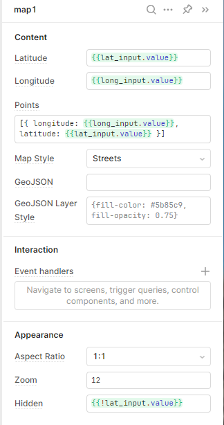
I'm also having some issue with below config. On desktop IDE, it all renders correctly.
On android phone, upon generating Lat/Long, the map zoom fly all the way to San Francisco. After I manually drag pan all the way to where the marker should be, it is generated correctly.