Plot multiple points on map with external API

Hi everyone, I'm having problems getting multiple points to appear on the mapbox. I need to display the location of various transport vehicles and the relevant data on altitude and longitude and other characteristics of the vehicle. I obtain them from an external API. This API provides me with the following results:

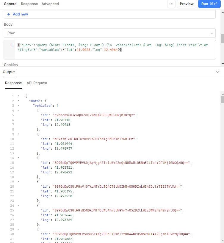
I specified in the "Latitude field name" section and in the longitude section the name that the API provides me ("lat" and "lgn") with this data but it gives no results.

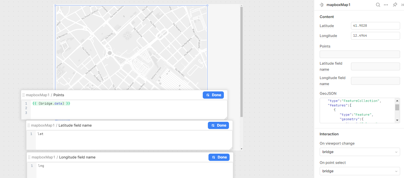
I tried to write with different commands to "filter" the data and take only "lat" or only "lng" but it always gave me errors. I probably wrote the code wrong but I really don't understand what I worng. can you help me solve this problem please :pray:

Welcome everyone ,they replied to me on discord and out of competence I am writing you the solution: {{ bridge.data.data.vehicles }}
The problem was that the coordinates are found in a "subsection" called "vehicles" but to be able to specify it you had to filter each "subfolder".
In my case the API gave me this result:
"response": {
"date": {
"date": {
"vehicles": [
{
"id": "YmlyZDpTQ09PVE",
"lat": 41.856268,
"lng": 12.62621,
{
"id": "YmlyZDpTQ09P",
"lat": 41.855495,
"lng": 12.620144,
....

So you had to filter for the "subfolder: data" then for the next one (which is also called "data") then for the one called "vehicles".

Bridge is the name of the Api-call that I gave it, so it depends on you what name you give them when you create the connection with the api.