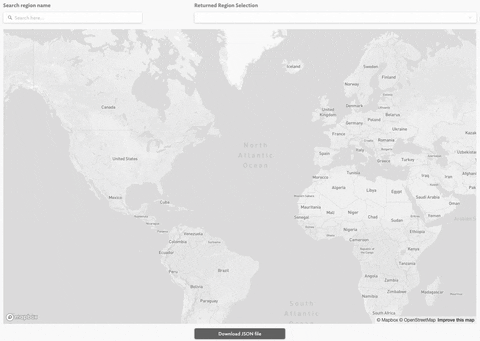
With the the help of the OpenStreetMaps API and Retool's intuitive map component, I was able to build an incredibly useful and very functional GeoJSON polygon search & download tool.
With this tool, you can search country, state, city, and even down to the granular level of buildings. What you do with this GeoJSON data is up to you, but this could easily be leveraged to very quickly create polygons or internal operation areas.
Included below the map, is the ability to download your selected region's GeoJSON data.
I am hoping this tool could be of some use to companies out there that rely on mapping and GeoJSON.
2 Likes
This is great! Just curious though, how did you draw the polygons? I noticed the bounding box annotator/labeller for images only allow square bounding boxes. I am looking for a polygon tool and just wondering how you went about it. Great work.
Very impressive, @wheels-justen! ![]()